
10 Secret Hikes in the Lake District the Locals Don’t Want You to Know About
- UK Hidden Gems

- Nov 6, 2025
- 14 min read
Hidden behind the famous peaks and well-trodden trails of Cumbria lies another side to the Lake District, one that only the locals whisper about.
Beyond the crowds at Scafell Pike and Helvellyn are secret paths that weave through forgotten valleys, ancient woodlands, and mirror-still tarns. These lesser-known hikes capture the raw, untamed beauty of the Lakes, offering peaceful solitude and views that feel entirely your own.
Whether you crave quiet moments beside a hidden tarn or a climb that rewards you with sweeping panoramas, these trails will steal your heart and perhaps your breath.
Each of these secret Lake District walks has its own story to tell. From the mossy slopes of Holme Fell to the remote stillness of Devoke Water, and the rugged charm of Lingmoor Fell, these are places where time seems to slow down.
They invite you to listen to the wind, smell the damp bracken, and watch the clouds drift lazily across distant ridges.
Lace up your boots, pack your flask, and get ready to discover ten hidden gems the locals would rather keep to themselves.

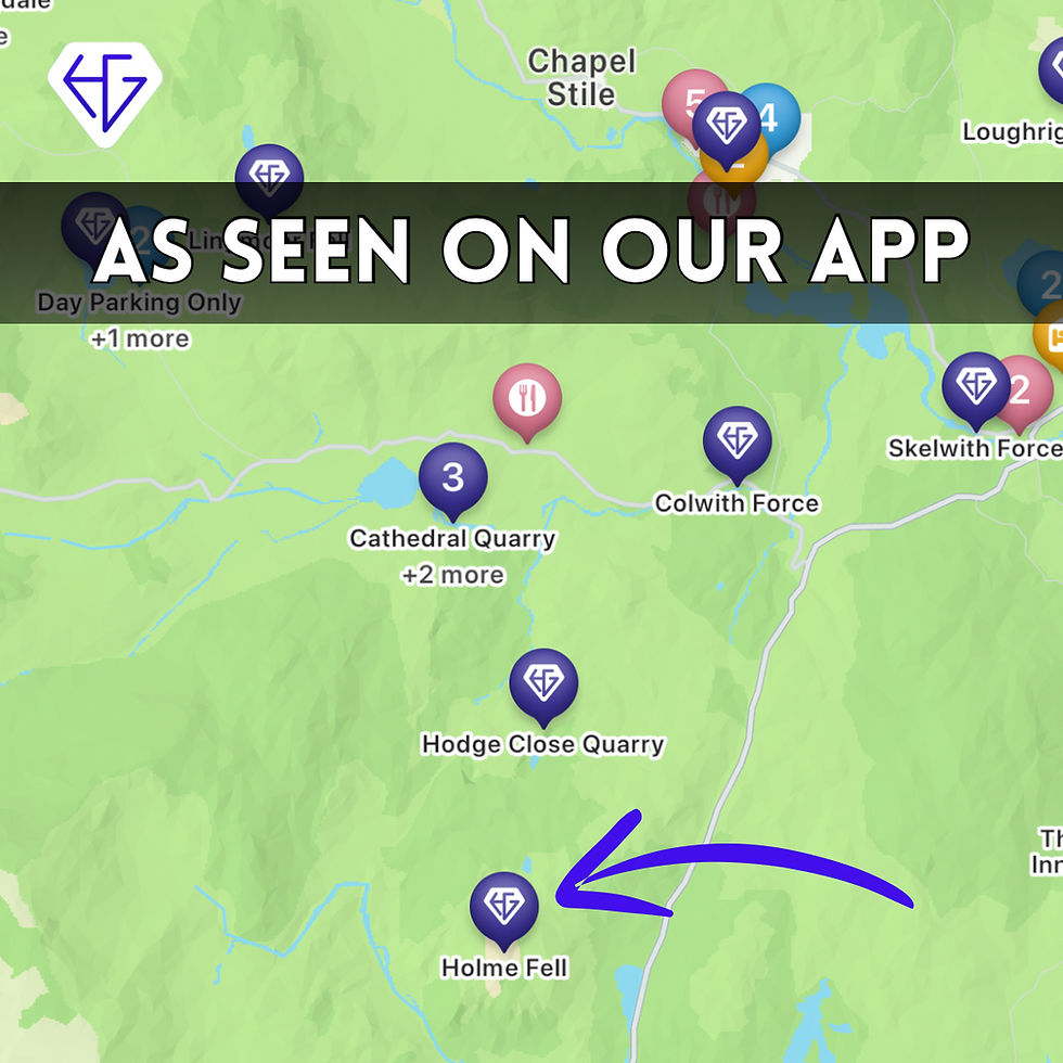
1) Holme Fell
Tucked between Coniston Water and Little Langdale, Holme Fell is a small but striking summit that rewards every step with incredible scenery.
The walk begins through a canopy of silver birch and oak, their leaves shimmering in the morning light. As you climb higher, the path opens to reveal heather-covered slopes dotted with old quarry ruins.
The air is rich with the scent of wet earth and pine needles, while the gentle sound of sheep bells echoes across the fells. You’ll catch glimpses of the Langdale Pikes in the distance, standing proud beyond the valley.
At the summit, a patchwork of lakes and ridges stretches in every direction, with Coniston Water glinting like a mirror below. It feels wild yet welcoming, as if time forgot to move on here. Even on a misty day, the atmosphere is magical, with clouds curling around the rocks like smoke.
The descent winds through paths lined with foxgloves and bracken, leading back to still pools where reflections ripple with colour. Holme Fell might be small, but its charm lingers long after your boots are clean.
FAQs/Things to know when visiting Holme Fell
Q1: How long does it take to hike Holme Fell?
Most walkers complete the Holme Fell route in about two hours, making it ideal for a short Lake District hike. The trail is moderate, with some steep sections but nothing too technical. It’s perfect for families or anyone looking for a quick adventure with stunning views.
Q2: Where is the best place to start the Holme Fell walk?
Many hikers begin near Yew Tree Tarn, just off the A593 between Coniston and Ambleside. This starting point offers easy parking and immediate access to scenic woodland trails. From here, you’ll reach the summit within an hour while enjoying peaceful surroundings far from the crowds.
Q3: Is Holme Fell suitable for dogs?
Yes, Holme Fell is one of the most dog-friendly hikes in the Lake District. The paths are grassy and open, and there are plenty of spots for water breaks. Always keep dogs under control around grazing sheep, but otherwise, it’s a wonderful place for four-legged explorers.

2) Devoke Water
Devoke Water is the Lake District’s largest tarn, and yet it remains beautifully untouched.
Nestled on Birker Fell, its windswept setting gives it a wild and lonely charm. The path skirts the shoreline, where reeds whisper in the breeze and skylarks rise above the heather.
You’ll often have the whole place to yourself, with only the soft ripple of water and the distant bleat of sheep for company. The reflections of clouds on the tarn’s surface create a mesmerising, painterly effect that shifts with every passing moment.
Around the tarn are gentle rises like Seat How and Rough Crag, giving you small summits with big views.
On clear days, you can see across to Scafell Pike and beyond, yet the sense of isolation never fades. It feels like stepping back a hundred years, when walkers roamed the fells without footprints to follow.
Pack a picnic and let the hours drift by with the sound of water against stone. Devoke Water is one of those secret Lake District spots that truly feels like your own discovery.
FAQs/Things to know when visiting Devoke Water
Q1: How do you get to Devoke Water?
Devoke Water is best accessed from the small road between Ulpha and Eskdale. There’s limited parking near the old gate at Birker Fell, from where a short walk leads you to the tarn. It’s a remote location, so always bring a map and proper gear, especially in bad weather.
Q2: Can you swim in Devoke Water?
Yes, wild swimming is allowed at Devoke Water, and it’s a favourite among locals who love secluded spots. The water is cold but clean, and the scenery adds to the magic of the experience. Always check the conditions before entering, as weather in the Lake District can change quickly.
Q3: Are there any facilities near Devoke Water?
There are no toilets, cafés, or visitor centres nearby, which is part of the tarn’s charm. The area feels remote and untouched, so plan ahead and bring everything you need. This wild, natural setting makes Devoke Water ideal for those seeking peace and solitude.


3) Lingmoor Fell
Lingmoor Fell rises proudly between Great Langdale and Little Langdale, offering some of the best panoramic views in the area.
The path begins gently, winding through ancient woodland before opening onto wide stretches of heath. In summer, the slopes burst into purple and gold as heather and gorse paint the fell in vivid colour.
As you climb, the surrounding peaks unfold like a painting, each ridge layered in soft light. The atmosphere is peaceful yet exhilarating, with every step revealing new horizons.
From the summit, the view sweeps across the Langdale Pikes, Crinkle Crags, and Windermere shimmering in the distance.
The wind up here carries a scent of moss and stone, and you’ll feel as though you’ve found the heart of the Lakes. The descent towards Blea Tarn is equally breathtaking, with reflections of sky and rock dancing on the still water.
Lingmoor Fell is a place that stays with you, its beauty quiet but deeply memorable. It’s one of those walks that reminds you why the Lake District is a world apart.
FAQs/Things to know when visiting Lingmoor Fell
Q1: What is the best route up Lingmoor Fell?
Many walkers start from the Old Dungeon Ghyll in Great Langdale, following the clear path towards Side Pike. This route offers a good mix of scenery, from crags to open fellside. It’s a moderate climb suitable for most walkers with basic fitness levels.
Q2: How difficult is Lingmoor Fell to climb?
Lingmoor Fell is considered a moderate hike with a few steep sections, but it’s manageable for most walkers. Good boots and steady footing will see you safely to the top. The rewards far outweigh the effort, especially on a clear day when the entire Langdale Valley unfolds below.
Q3: Is Lingmoor Fell busy with tourists?
Compared to nearby fells like Loughrigg or Fairfield, Lingmoor is much quieter. You may meet a few keen photographers or local walkers, but it never feels crowded. It’s one of those Lake District hikes that still feels undiscovered, even though it’s close to popular areas.


4) Great Langdale
Great Langdale is one of those valleys that quietly steals your heart. Its broad floor is framed by rugged fells, glacial boulders, and a ribbon of winding streams that sparkle in the light.
Walking here feels like entering an old Lakeland tale, where every stone wall and sheepfold holds a story. The path begins near the Old Dungeon Ghyll, where boots crunch over gravel and the scent of peat drifts on the breeze. As you move deeper into the valley, the views stretch toward the Langdale Pikes, their jagged peaks cutting sharply against the sky.
The sound of running water follows you as the trail passes meadows and quiet farmsteads that have stood for centuries.
You may see fell runners darting by or hear curlews calling across the moorland. The climb toward Stickle Tarn offers a striking reward, with its mirror-like surface reflecting the cliffs of Pavey Ark.
Sit for a while here and you’ll feel the valley’s rhythm slow your heartbeat. Great Langdale is more than a place to walk; it’s a reminder of the Lake District’s timeless spirit.
FAQs/Things to know when visiting Great Langdale
Q1: How long is the Great Langdale walk?
The main circular route through Great Langdale takes around four to five hours. It covers a variety of terrain, including valley paths, rocky trails, and gentle climbs. Many walkers extend the route by visiting Stickle Tarn or heading towards Bowfell for extra adventure.
Q2: Where can you park for the Great Langdale walk?
There are several car parks in the valley, including the National Trust car park near the Old Dungeon Ghyll Hotel. Arriving early is best, especially during weekends and holidays. Public buses from Ambleside also run directly into Great Langdale, making it easy to access without a car.
Q3: What is Great Langdale known for?
Great Langdale is famous for its dramatic scenery and its connection to traditional Lakeland farming. The valley is also a starting point for classic climbs like the Langdale Pikes and Crinkle Crags. Despite its reputation, there are still quieter trails within it that only locals tend to explore.


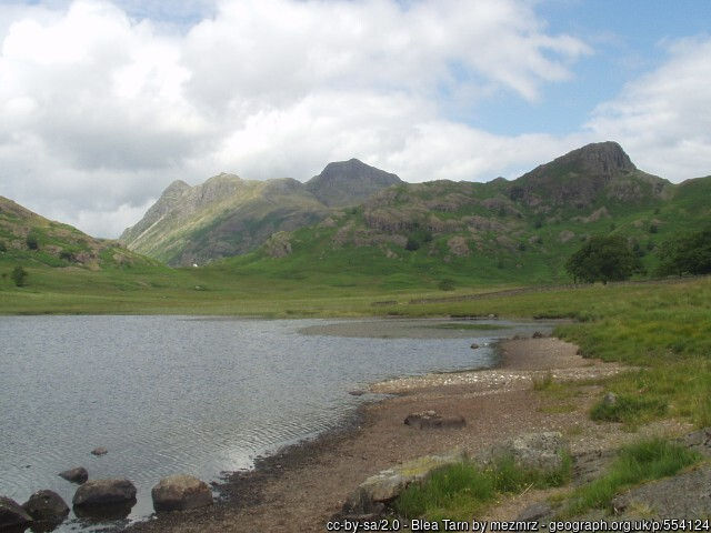
5) Blea Tarn
Nestled between the rugged shoulders of Lingmoor Fell and Pike o’ Blisco, Blea Tarn feels like a secret kept in plain sight.
The small lake sits in a bowl of hills, perfectly still on calm mornings when the reflections are flawless. A gentle path loops around it, offering breathtaking views at every turn.
The surrounding heather and rushes whisper softly in the wind, and the sound of water lapping the shore brings a soothing calm. If you arrive early, the sun spills over the peaks, turning the tarn to molten gold.
This is one of those Lake District places that feels suspended in time. A short walk from the National Trust car park leads you straight into wild scenery that looks untouched for centuries.
You’ll often find photographers setting up their tripods, drawn by the balance of rock, water, and sky.
Sit quietly on a boulder and you may spot dragonflies skimming the surface or hear a buzzard circling above. Blea Tarn’s beauty is simple but unforgettable, a perfect escape for anyone seeking peace and perspective.
FAQs/Things to know when visiting Blea Tarn
Q1: Is Blea Tarn an easy walk?
Yes, the loop around Blea Tarn is one of the easiest and most accessible walks in the Lake District. The well-maintained path makes it suitable for families, beginners, and casual strollers. Despite its ease, the scenery is among the most beautiful you’ll find anywhere in Cumbria.
Q2: Can you swim in Blea Tarn?
While some people do swim in Blea Tarn, it’s not officially designated as a swimming spot. The water can be extremely cold and deep in places, so caution is advised. Most visitors prefer to paddle, picnic, or simply enjoy the peaceful setting from the shoreline.
Q3: When is the best time to visit Blea Tarn?
Early mornings or late afternoons provide the best light for photography and reflection shots. Autumn is particularly stunning when the surrounding bracken and trees glow in amber tones. Visiting outside peak tourist hours ensures you’ll enjoy the serenity that makes Blea Tarn so special.

6) Loughrigg Terrace
Overlooking Grasmere and Rydal Water, Loughrigg Terrace is one of the Lake District’s most scenic and secretive ridge walks.
The path rolls gently above the lakes, offering spectacular views that change with every turn. As you climb from the edge of Grasmere, the scent of wildflowers and damp soil fills the air.
The water below sparkles through breaks in the trees, and birdsong echoes off the rocky slopes. Even on busy weekends, this terrace remains remarkably peaceful, with long stretches where you might not meet another soul.
At the top, the panorama opens wide to reveal Windermere in the far distance. The play of light across the fells makes every visit unique, especially at sunset when the sky turns rose and gold.
The descent towards Rydal Water is soft and winding, shaded by ancient oaks and bracken.
This walk combines beauty and accessibility, making it a hidden gem just minutes from the tourist hub of Ambleside. Once you’ve walked Loughrigg Terrace, you’ll understand why locals prefer to keep it a quiet secret.
FAQs/Things to know when visiting Loughrigg Terrace
Q1: How long is the Loughrigg Terrace walk?
The route across Loughrigg Terrace takes around two to three hours depending on your pace. It’s a moderate walk with a few gentle climbs and plenty of scenic spots to stop. The circular trail can be started from either Grasmere or Rydal, making it easy to plan around your day.
Q2: Is Loughrigg Terrace suitable for beginners?
Yes, this walk is perfect for beginners or families looking for an achievable but rewarding route. The paths are well-marked and the gradients are mild. You still get incredible views without needing to climb high peaks, making it a great introduction to Lake District hiking.
Q3: Are there any cafés near Loughrigg Terrace?
Yes, both Grasmere and Rydal villages have cosy cafés and tearooms nearby. Many hikers reward themselves with coffee or homemade cake after finishing the route. This blend of natural beauty and convenience is one reason Loughrigg Terrace is a local favourite.


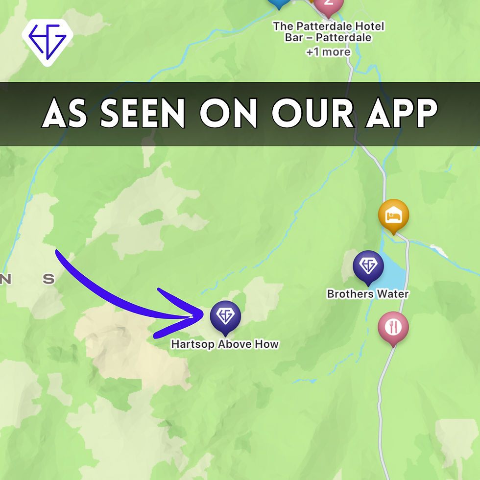
7) Hartsop Above How
Hartsop Above How is a ridge that feels like a secret in plain sight. Rising gently above the small village of Hartsop, it offers breathtaking views across Brothers Water and the surrounding fells.
The walk begins through meadows dotted with stone barns and wandering sheep, before climbing gradually onto the open fell. The scent of damp grass and fresh mountain air fills your lungs, while the sound of the stream follows you upwards. It’s one of those climbs that feels peaceful rather than punishing, perfect for walkers who love quiet trails.
Once on the ridge, the view opens up in every direction; Fairfield to the west, St Sunday Crag to the north, and the long spine of the Helvellyn range beyond.
On calm days, the stillness is profound, broken only by skylarks and the rustle of grass. The sense of space is overwhelming yet comforting, as though the whole valley is watching over you.
The descent back to Hartsop is gentle, winding through gorse and fern until you reach the valley floor again. Few visitors ever find this ridge, which is exactly why locals cherish it.
FAQs/Things to know when visiting Hartsop Above How
Q1: How do you reach Hartsop Above How?
The walk starts from Hartsop village, just a short drive from Patterdale or Brothers Water. There’s limited parking near the old bridge and farm buildings. From there, clear paths lead onto the ridge, offering spectacular views almost immediately.
Q2: Is Hartsop Above How suitable for beginners?
Yes, it’s an ideal introduction to ridge walking in the Lake District. The gradients are manageable, and there are no technical sections or scrambles. Beginners will enjoy a real sense of adventure without the intensity of higher climbs like Helvellyn.
Q3: When is the best time to walk Hartsop Above How?
Late spring and early autumn are particularly lovely, when the valley colours are at their richest. Morning walks often bring low mist that lifts to reveal sweeping mountain views. It’s quieter than nearby routes year-round, making it perfect for peaceful exploration.

8) Castle Crag
Castle Crag, though one of the smallest Wainwrights, is among the most characterful. Nestled in Borrowdale, this steep little hill rises above the river like a fortress, its summit marked by old slate spoil and weathered cairns.
The walk begins along wooded paths where the scent of wild garlic fills the air in spring. Shafts of sunlight break through the trees, glinting off the river Derwent below. As you climb, the woodland gives way to open slopes strewn with fragments of slate from long-forgotten quarries.
The summit view is spectacular despite its modest height, with Derwentwater shining below and the distant ridges of Skiddaw and Blencathra beyond.
The sense of history is strong here, you can almost hear the echo of pickaxes and the murmur of workers long gone. On windy days, the air hums softly around the stones, adding to the magic.
It’s a short but steep climb that rewards every ounce of effort. Castle Crag may be small, but it captures the heart of the Lake District in a single sweep of landscape.
FAQs/Things to know when visiting Castle Crag
Q1: How long does it take to climb Castle Crag?
The hike usually takes between one and two hours, depending on your pace. It’s a short route, but the final climb is steep and rocky. Despite its size, it offers panoramic views that rival many higher summits.
Q2: Where do you start the Castle Crag walk?
Most walkers begin from the village of Rosthwaite in Borrowdale. From there, the path is clearly marked and follows the River Derwent before climbing towards the crag. It’s a scenic and varied route with a mix of woodland and open fellside.
Q3: Is Castle Crag family-friendly?
Yes, it’s one of the most enjoyable short walks for families in the Lake District. Children often love the rocky summit and the sense of reaching a real “castle” peak. Just take care on the loose slate near the top, which can be slippery in wet weather.


9) Grisedale Pike
Grisedale Pike is a sharp, elegant mountain that dominates the skyline above Whinlatter. The walk begins with a steady ascent from Braithwaite, rising through bracken and heather before the view suddenly bursts open.
As you climb, the ridge narrows and the wind grows cooler, carrying the scent of peat and moss. Below, Bassenthwaite Lake glimmers like a sheet of glass framed by forest and meadow. Every step feels like progress towards something truly special, as the views expand with each turn of the path.
The summit of Grisedale Pike is slender and windswept, offering 360-degree views of the Northern Fells.
To the north lies Skiddaw, while to the west the Solway Firth shimmers faintly in the distance. It’s a spot that inspires awe and silence in equal measure, as though the world holds its breath around you.
The descent via Hobcarton End offers a gentler return, lined with mountain streams and lichen-covered rocks. Grisedale Pike is a classic climb that somehow remains a secret to many who visit the Lakes.
FAQs/Things to know when visiting Grisedale Pike
Q1: Is Grisedale Pike a difficult hike?
Grisedale Pike is classed as a moderate-to-hard walk due to its steep ascents and narrow ridges. However, it’s manageable for fit walkers with good footwear and some experience. The clear paths and rewarding views make the effort entirely worthwhile.
Q2: How long does the Grisedale Pike walk take?
Most walkers complete the circular route in about four to five hours. The ascent is steep at first but eases along the ridge. Many choose to extend the route to include Hopegill Head or Coledale for a full day on the fells.
Q3: Can you park near Grisedale Pike?
Yes, there’s parking available in Braithwaite village at the start of the main route. Spaces fill quickly in good weather, so arriving early is best. The village also has a pub and small shop, perfect for refreshments after your walk.


10) Sale Fell
Sale Fell lies quietly near Bassenthwaite, often overlooked by visitors rushing towards higher peaks. Yet this gentle fell offers one of the most peaceful hikes in the Lake District.
The route begins with a gradual climb through grassy pastures, where skylarks sing overhead and the breeze hums through the long grass.
The views open almost immediately, stretching towards the Solway coast and the distant outlines of Scotland on clear days. It’s a place where you can truly breathe, away from crowds and clatter.
The summit itself is modest but beautiful, with wide horizons and a deep sense of calm. Sheep graze lazily on the slopes, and the air smells faintly of wild thyme and bracken.
On late summer evenings, the hill glows amber in the setting sun, creating a perfect place to linger.
The descent loops back through quiet woodland and hidden paths that feel untouched for centuries. Sale Fell is proof that sometimes the smallest walks bring the biggest rewards.
FAQs/Things to know when visiting Sale Fell
Q1: Is Sale Fell suitable for beginners?
Yes, Sale Fell is one of the best beginner-friendly walks in the Lake District. The gradients are easy, and the paths are clear and safe for families. It’s a great introduction to fell walking without the challenges of higher summits.
Q2: How long does it take to walk Sale Fell?
The circular route takes about two hours at a leisurely pace. It’s short but wonderfully varied, with open views, gentle climbs, and peaceful valleys. Many locals use it for an evening stroll or quick escape into nature.
Q3: Can you see the sea from Sale Fell?
Yes, on clear days you can see across the Solway Firth and even glimpse Scotland on the horizon. This unique coastal view makes Sale Fell different from most Lake District hills. It’s especially striking at sunset when the water catches the last light of the day.

The Lake District is full of famous names, but its quiet corners hold the real magic. From the heather-clad ridges of Holme Fell to the mirror-still beauty of Devoke Water and the windswept heights of Grisedale Pike, these secret hikes capture the soul of the region.
Each trail offers something different; solitude, history, wild beauty, or simply a chance to slow down. Whether you choose the gentle slopes of Sale Fell or the rugged drama of Great Langdale, every step connects you to a landscape shaped by centuries of wind and water.
Exploring these lesser-known walks means discovering the Lake District the way locals do, quietly, thoughtfully, and without rush. You’ll find peace on hidden ridges, reflections in still tarns, and stories carved into stone walls
Download the official APP!
Gain access to over 1,600 hidden gems and their co-ordinates all over the UK when you download our app. Add gems to your bucket-list and tick them off as you go along, as well as earn rewards/badges when you visit a certain amount.


Comments